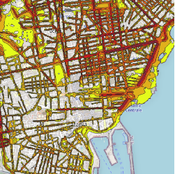
La rilevazione AREALE consiste in una rilevazione porta a porta di tutte le unità di rilevazione (ovvero le famiglie) presenti in una data area, svolta da parte di un incaricato del Comune munito di cartellino di riconoscimento e di un tablet e che effettuerà l'intervista direttamente al domicilio della famiglia.
Il periodo di effettuazione di questa indagine è compreso tra il 13 ottobre e il 17 novembre 2022.
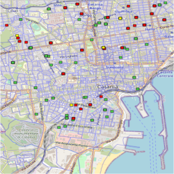
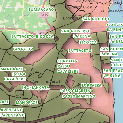
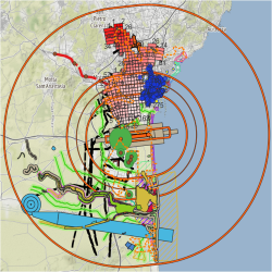
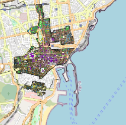
La mappa illustra gli indirizzi associati ai rilevatori comunali incaricati del censimento 2022.
N.B.: I dati pubblicati hanno solo un valore statistico e non probatorio.
Nella rilevazione da LISTA le persone coinvolte in questa indagine, individuate su base campionaria, saranno contattate dall'ISTAT tramite una lettera, nella quale la famiglia sarà invitata alla compilazione on-line del questionario, nel periodo che inizia dal 3 ottobre al 12 dicembre 2022. Se per il nucleo familiare contattato non fosse possibile rispondere via web, saranno disponibili degli operatori presso il CCR - Centro Comunale di Rilevazione per eventuali richieste di assistenza.
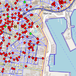
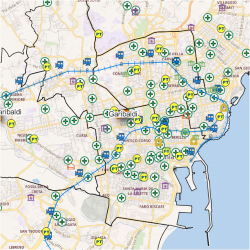
La mappa illustra gli indirizzi associati ai questionari ed evidenzia lo stato di compilazione degli stessi.
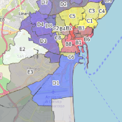
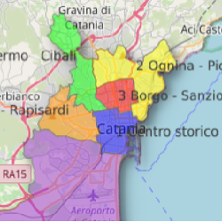
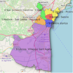
Per ulteriori info sul numero di residenti per circoscrizione seguire il link:
http://map.comune.catania.it/index.php/view/map/?repository=sit&project=circoscrizioni_popolazione
N.B.: I dati pubblicati hanno solo un valore statistico e non probatorio.
Dati dell'Osservatorio Mercato Immobiliare a cura dell'Agenzia delle Entrate
https://www.agenziaentrate.gov.it/portale/schede/fabbricatiterreni/omi/banche-dati/quotazioni-immobiliari
Le quotazioni immobiliari semestrali individuano, per ogni delimitata zona territoriale omogenea (zona OMI) di ciascun comune, un intervallo minimo/massimo, per unità di superficie in euro al mq, dei valori di mercato e locazione, per tipologia immobiliare e stato di conservazione. Quando per una stessa tipologia sono valorizzati più stati di conservazione è comunque specificato quello prevalente. In particolare:
per Box, Posti auto ed autorimesse non risulta significativo il diverso apprezzamento del mercato secondo lo stato conservativo;
per Negozi e Centri commerciali il giudizio Ottimo (O) / Normale (N) / Scadente (S) è da intendersi riferito alla posizione commerciale e non allo stato conservativo dell’unità immobiliare.
Le quotazioni OMI, disponibili in un semestre, sono relative ai comuni censiti negli archivi catastali. E’ quindi, possibile che l’elenco dei comuni presenti in Banca Dati differisca nei diversi semestri per effetto di variazioni circoscrizionali (in esito alle quali sono costituiti nuovi comuni e soppressi altri).
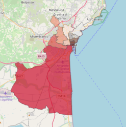
Sezioni, Affluenze e Risultati Elezioni Amministrative 2023
Illustration
Title
Sezioni, Affluenze e Risultati Elezioni Amministrative 2023
Abstract
Cliccare sul punto che rappresenta l'edificio scolastico di interesse per ottenere, per
ciascuna sezione elettorale, informazioni sull'affluenza degli elettori e sul risultato finale.
E' anche possibile operare una ricerca per sezione elettorale o per edificio scolastico
utilizzando il pannello laterale "Localizzazione" posto in alto a sinistra della mappa.
N.B.: I dati pubblicati hanno solo un valore statistico e non probatorio.
N.B.: I dati pubblicati hanno solo un valore statistico e non probatorio.
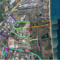
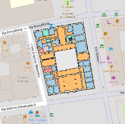
I file dwg da cui sono stati ricavati i pdf visualizzabili sono stati realizzati:
1) da "ATISS CONSORZIO" per la "Gestione delle emergenze" del Comune di Catania;
2) dallo "Studio di fattibilità per il riuso dei grandi contenitori edilizi urbani" - "Recuperare Catania - Associazione professionale tra ingegneri ed architetti" - Comune di Catania;
3) da elaborazioni di questo Ufficio S.I.T. del Comune di Catania, per quanto attiene la caratterizzazione delle destinazioni d'uso degli ambienti di alcuni edifici.
4) Dal "Progetto del Centro Sociale di Nesima Inferiore nel quartiere di San Leone" - Comune di Catania (progettisti: Arch. Ezio Rizzo, Ing. Antonio Maria Spina, Arch. Maurizio Spina)