OpenData


SIT Catania

Base Layer
- Title
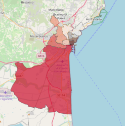
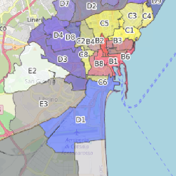
- CensimentoAreale
- Description
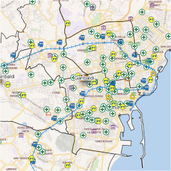
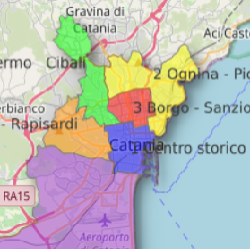
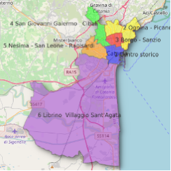
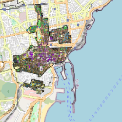
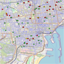
- La rilevazione AREALE consiste in una rilevazione porta a porta di tutte le unità di rilevazione (ovvero le famiglie) presenti in una data area, svolta da parte di un incaricato del Comune munito di cartellino di riconoscimento e di un tablet e che effettuerà l'intervista direttamente al domicilio della famiglia.
Il periodo di effettuazione di questa indagine è compreso tra il 13 ottobre e il 17 novembre 2022.
La mappa illustra gli indirizzi associati ai rilevatori comunali incaricati del censimento 2022.
N.B.: I dati pubblicati hanno solo un valore statistico e non probatorio.
- Website
- https://www.comune.catania.it/il-comune/uffici/anagrafe/gli-uffici/statistica/censimento-permanente-popolazione-e-abitazioni/2018.aspx
- Projection
- EPSG:3857
- Extent
- 1653583.6893422978464514, 4489503.18052983563393354, 1702955.67195261712186038, 4517674.25296042952686548